|
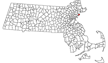
MarbleheadOfficial Website: www.marblehead.org
County: Essex
Region: Lynn Area & North Shore
Year Settled: 1629
Incorporated as a Town: 1649
Land Area: 4.5 sq. miles
Population Density: 4,498 people/sq mile
Population from Census 2000: 20,377
Estimated Population for 2006: 20,231
Racial makeup of population: [+] show
| 96.9% | White | | 0.4% | Black | | 0.9% | Hispanic | | 1.0% | Asian | | 0.1% | Native American | | 0.7% | Other |
Median Household Income (2005): $82,000
Median Housing Unit Value in 2000: $336,000
Median Single Family House Sale Price in 2006: $585,000
Poverty: 4.3%
Violent Crime Index: 6 (very low)
Property Crime Index: 16 (average)
Crime compared to USA: Very Low
Nearest Hospital (ER): Salem Hospital (Salem), Beverly Hospital (Beverly)
Marblehead is a small seaside town on Boston's North Shore between the towns of Swampscott and Salem. It is known locally as the "Yachting Capital of America" due to its many yacht clubs and large harbor, and the town is sometimes called the birthplace of the American Navy. Marblehead also was heavily involved in merchant shipping in the 1700s and commercial fishing in the 1800s. The town consists of the main town plus Marblehead Neck which used to be an island but is now connected to the mainland with a causeway and is full of big expensive houses. In between these areas is the harbor which is filled with boats in summer.
While Marblehead is often listed as a tourist town in travel guides, it doesn't really attract many tourists and doesn't have much of a tourism infrastructure. It does have lots of boats, scenic views, historic buildings, and downtown areas with various boutique shops and art galleries. Most of the shops, restaurants, and attractions are located on Washington Street, Pleasant Street, and Atlantic Avenue. Every year around the 4th of July the town holds the Marblehead Festival of Arts which attracts many artisans and visitors. Also in summer there are many sailing regatttas including the popular NOOD Regatta in July.
Getting There
Most travelers would take I-95 to Route 128 (Yankee Division Highway) to Peabody then pick up Route 114 through Salem south to Marblehead. You can also take Route 1A north from Boston to Swampscott then take Route 129 or Vinnin Street east into Marblehead. If your GPS navigation insists on taking you on I-90 through the center of Boston, you may experience significant delays due to traffic. I-95 and 128 can also have heavy traffic but not likely as bad.
Points of Interest
- Marblehead Information Booth: Tiny information booth in the center of an intersection between Pleasant Street (at Spring Street), Essex Street, and Bassett Street. This is located at the north end of the Downtown area.
- Chandler Hovey Park: Located at the end of Marblehead Neck. It has a skeleton lighthouse, a small rocky beach, and lots of benches to sit on and enjoy the beautiful views of the harbor especially at sunset.
- Castle Rock: A rocky outcropping and tiny park along the coastline with picturesque views. Located on the east side of Marblehead Neck at about 377 Ocean Avenue. If you have time after visiting Chandler Hovey Park then take a quick detour, park along the street and walk down the short path.
- Devereux Beach: A good sized swimming beach with a pavilion, restrooms, a cafe, and a playground. It is the only major public beach in Marblehead, and is located at the beginning of the causeway leading to Marblehead Neck. Across the street is a boat launch and area renting kayaks and paddle boards.
- Old Town: This section of town has narrow streets, a few shops and restaurants, and many historic houses that were built in the 1600s to 1800s. A few are now museums such as the Jeremiah Lee Mansion, the J.O.J. Frost Gallery (a.k.a. Marblehead Museum), and the Civil War & Grand Army of the Republic Museum. The Marblehead Arts Association has a gallery in the King Hooper Mansion around the corner from the Jeremiah Lee Mansion. Abbot Hall, which is the town hall (open to the public and free) has the famous painting "The Spirit of '76" and other artwork on display. The main area of interest in "Old Town" is Washington Street from Washington Square north to just past State Street, then east down State Street to Front Street. Off of Front Street is Ferry Lane and the Town Wharf. Next to the Town Wharf (on Crocker Park Lane) is Crocker Park which has nice views of the harbor. The Marblehead Historical Commission has a website with more information and a good map with a walking tour.
- Downtown: The newer downtown area has lots of restaurants and boutique shops. It runs mostly along Pleasant Street (from Bessom Street north to Spring Street), south along School Street, and on Atlantic Avenue (from Washington Street south to Chestnut Street). The commercial downtown area and Old Town are only about three blocks apart on Washington Street (or Pleasant Street).
- Fort Sewall: The remains of a former fort and is now a small park. It's located on the northeast side of the mainland.
- Little Harbor Boathouse: Kayak and standup paddle board rental and sales shop that also has guided tours.
- Marblehead Neck Wildlife Sanctuary: A wildlife area near the center of Marblehead Neck that is preserved by the Mass Audubon Society and is a haven for migratory birds. There are 3/4 of a mile of trails.
- Old Burial Hill: A historic cemetery dating to the early 1600s which is supposedly haunted by the ghost of the only Marblehead resident hanged during the Salem witch trials. The hill has interestingly carved tombstones and scenic views of the harbor.
Tourist Attractions
- Chandler Hovey Park
- Devereux Beach
- Crocker Park
- Fort Sewall
- Marblehead Festival of Arts
- J.O.J. Frost Gallery (part of Marblehead Museum)
- Jeremiah Lee Mansion & Gardens (part of Marblehead Museum)
- Civil War & Grand Army of the Republic Museum (part of Marblehead Museum)
- Little Harbor Boathouse
Restrooms
There are public restrooms at Abbot Hall, the Town Wharf, Crocker Park, Fort Sewall, Chandler Hovey Park, and Devereux Beach.
Parking
There are very few areas to park in Marblehead. There are no major public parking lots and no garages. Some streets allow parking. Most public parking areas are metered and/or have a 2 hour time limit. Here's a list of possible parking areas:
Near Old Town, the Wharf, and Crocker Park
- Along Washington Street and Rockaway Street (street parking)
- Along Washington Square (there's a few street parking spaces around the square)
- State Street Landing (Tucker's Wharf) at 77 Front Street (small public lot)
- Town Wharf at 9 Ferry Lane (public)
- Crosby's Marketplace, 118 Washington Street (small private shopping center; may tow non-customers)
- Don't park at the Boston Yacht Club or you may be towed.
Near Downtown
- Along Pleasant Street (street parking)
- Marblehead Village Market, 165 Pleasant Street (private shopping center)
- Warwick Place, 123 Pleasant Street (private shopping center with parking in back)
- Along Round House Road, off Bessom Street (street parking)
- Seaside Park public lot behind Seaside Nursury School, 80 Atlantic Avenue (alley before Ace Hardware)
- Our Lady, Star of the Sea church lot, 85 Atlantic Avenue (possibly if there are no services)
Near Fort Seawall and Fort Beach
- Fort Beach, small public lot at the corner of Front Street and Fort Beach Lane
- Front Street (a few spaces from Franklin Street to Fort Beach Lane)
- Little Harbor Boathouse, 40 Doaks Lane (private)
Other Parking Areas
- Marblehead Chamber of Commerce, 62 Pleasant Street (a few spaces, but ask before leaving your vehicle there)
- Village School Athletic Fields (street parking, but this is far from downtown)
- Devereux Beach, 99 Ocean Ave, 2 large lots, but far from the other areas and expensive from 8am to 4 pm.
|
|
|


